Tuesday, July 31, 2007

Wind River Range Day 2: Chutes and Ladders

I slept in relatively late on the second day of my backpacking trip in the Wind River Range and got on the trail around 10 AM. I continued to work my way out of the valley that I had hiked up the day before and eventually came to an amazing land of alpine meadows. The wildflowers in the morning were simply stunning:


As I continued, the scene became more and more open, rugged, and ridiculously beautiful. Ludacrisly beautiful. The high alpine practically nudges the peaks only a couple of hundred vertical above the basin. At some point I dropped my pack and bagged a random unknown peak. It was there.

I continued my merry way through the alpine in an incredibly cheery mood when my first tactical mistake was made. I'm relatively used to the trails in the NorthEast that romp their way over peaks, but most of the high points around this area are too cliffy for trails; I had managed to practically mentally flip the up/down hiking of the rest of the day in my mind. What I thought was going to be a steep valley became a mountain pass:


I would continue down to that little Lake (way the heck down there) where I would see another bull moose tromping away from me. It was 3:30 and I discovered that I had only gone 3.5 miles out of my projected 11 or 12 for the day. I had stopped so frequently to take pictures and bask in the views that I was going stupidly slow. Not only that, I had another flip where I expected to go DOWN a valley where my direction would actually go UP the valley. It was time to crank on the gas. But I want to take piiiiiicturess......

I hiked hard up the valley for about 3 miles before coming to a junction where I turned West into a region known as No Name Lakes (most of them actually have names). I was back above treeline (with a few pine tree exceptions) and climbed in and out of what felt like dozens of little basin with random lakes (probably more like five).


It felt like the lakes would never end when finally I came to Palmer Lake and decided to call it a day (ok, it was getting dark and I was exhausted).

I settled into my bivy only to watch lightning across the mountain ridge. I had to get my head around this.... If it rained, I would probably get soaked and the lightning made me think too hard about wildfires (a serious issue...) Finally I dozed off after another indescribable day.

Saturday, July 28, 2007

Wind River Range

Last weekend was pretty uber. This Tuesday was Pioneer Day (in short, the day the Morman posse arrived in the Salt Lake Valley and decided to chill here) so I was off work and snagged a vacation day on Monday to procure a four day weekend.

I had wanted to check out the Yellowstone/Grand Teton area for a while and got some good information on a three-day backpacking loop hike in the Wind River Range. This range isn't actually in the National Parks, but it's on the same ridge (the Continental Divide) and meant I wouldn't have to deal with permits or hordes of people.

Day 1:

I set off for Pinedale, Wyoming and the trailhead; driving through Wyoming was interesting, it's really pretty flat and filled with small towns until you hit the mountains. And I mean REAL small towns. Most of these places had less than 500 people and I couldn't help but wonder what they do for a living (I hypothesize the answer may be cattle ranch stuff).

Somewhere along the drive I discovered I had no pot to boil water. This means my freeze dried dinners would be... freeze dried... and my oatmeal would be dry too. I stopped in Pinedale and picked up a pot. A random lucky close call.

I took off from the trailhead after registering and all that. There are grizzly and brown bears in the wilderness and signs declared this in a way that made me think I was guaranteed to get eaten. A couple miles later, I passed this on the trail:


Shnikeys... Hmmmmmmm.... Well...... Ok.

My first day was spent mostly working my way up a creek drainage that was absolutely beautiful. You forget how much mileage you can cover in one day and I was surprised at how far back in the canyon I was getting.


I saw not one, but three moose along that river. One of which was a bull (male), these dudes are big and scary. We had a classic moment of "Looking-At-Me-Looking-At-You" before deciding that we were friends and not food (phew).


I started the climb out of the valley that night and found a campsite along a stream on a little bluff overlooking the valley. In an effort to cut some weight, I hadn't brought a tent and was instead using a bivy sack (sort of like a waterproof cocoon for your sleeping bag) and a tarp. Sleeping with the sunset and under the stars was magnificent.


I'll post day two and three in the next couple days...

Monday, July 16, 2007

Pfeifferhorn

Aye! I'm sort of frustrated with not updating this... but I've been one busy dude!

Two weekends ago I went on a hiking trip up a peak in the Wasatch range called the Pfeifferhorn. I explained my plans to some of my co-workers at the bar on Friday and Greg agreed to join me. He'd been thinking about the peak for a while and it was a good way to group up. The Pfeif doesn't have a trail to the top so it requires a bit of navigation and a lot of boulder scrambling so two is probably better for safety.

We met up at 7 AM and begin the ascent. The first three or four miles were straightforward on a trail to Red Pine Lake. After Red Pine we began the scramble up to a ridge. The views down into the lake were pretty awesome:


Eventually we found the ridge and a quick jaunt got us to the summit cone proper:


Our ascent route was that sort of left gully almost dead center in this picture. The climbing was pretty good and the views would clearly be rewarding.


The way down was tough on the feet as the boulders were not forgiving... The lake and real trail were quite a welcome sign...

Greg is training for the Wasatch 100 which is a run covering 100 miles (naturally) of rugged mountain trails in one body killing day. So he decided to run the rest of the way down to train and was considering doing another run back up another trail... schnikeys...

I went the chill route and opted to hang out by the lake and relax and enjoy the mountains. The wildflowers are out and are pretty awesome; I enjoyed them on the way down:


Rock steady!

Monday, July 9, 2007

Ah, the 4th of July.... was days ago....

I visited New York and the family for the weekend and half of the week until the 4th of July. It was good to see family including Aunts/Uncles/Grandparents I only get to see a couple of times a year.

We did the usual, a lot of relaxing, beaching, boating etc. I waterskied a couple times and wish I could have more. Waterskiing is a great outdoor sport for it's utter pointlessness. Hikers, bikers, canoers, etc. all use their sports to travel and have historic adventurous roots. Organized sports develop teamwork and strategy. Waterskiing is just the sheer glory of racing around getting dragged behind a boat. Bliss.

We also checked out the Sandy Creek County Fair. An event for the highly cultured, the demolition derby was awesome as always:


Carnage! I think this was following the firefighters righting a flipped car. The flipped car continued in the demolition heat like a champ.

Monday, June 25, 2007

Timpanogos!

Geez! Another weekend gone by....

This weekend I felt like staying close and opted for a day hike of Mt. Timpanogos which is about a 45 minute drive away from my apartment. Timpanogos is pretty cool because it's one of the lower 48's Ultra Prominence peaks. What's this mean? In general, it's a big honking mountain. If you're really interested check this out.

It's hot in SLC valley and was supposed to get to 106 on Saturday so the alarm went off at 4.30 AM for me to get moving up the trail pre-heat wave. I hit the trail at six and started the 7ish mile tromp to the summit. Part way along the trail I stumbled across two moose. I love moose. They're so funky.


I continued along the trail and enjoyed watching the sun rise over the valley behind me. Pretty soon I found myself in the Timpanogos Basin and basked in the glory of the peak:


By around 10 I was on top and enjoying the views.


I had heard word of a "glacier" on the peak and had scouted it out on the way up. You can see it in the picture of the peak off to the left. It looked like a sweet fast sled down but I was concerned about making the 1000+ vertical foot high speed descent alone. I met two guys on the peak who were talking about going that way and joined them for a bit of safety. Somehow we picked up some more people and ended up with a crew of eight. A quick hike over to the snowfield presented a beautiful fast butt sled with a little bit of ice axe speed/rudder control.... quality:


We descended another snowfield in high fashion and returned to the basin. I sort of slipped out of the group somewhere in here. Eight is a bit of a big group and I was up for a slow descent to enjoy the views. The trip down was uneventful besides more beautiful views....

Friday, June 22, 2007

Zion! Slotastic!

Last weekend, I joined the University of Utah Outdoors group in a trip down to Zion National Park. A few went down good and early on Friday to get us passes to hike the entirety of The Narrows on Saturday. I rolled down to the area around 10.30 PM Friday (5 hour drive... ish). Hung out meeting people and playing corporate ladder (remember that!?) until the last car finally pulled in at like midnight or something.

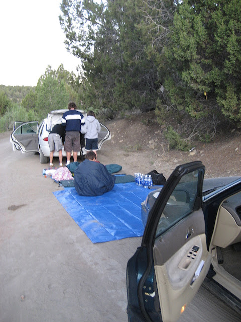
After getting organized, we realized there was some tricky logistics involved in the hike. It's a sixteen mile one-way hike through a narrow slot canyon and we needed to shuttle cars to the top and start up there in the morning. We started driving along dirt roads to get to the trailhead around 1.30 AM and finally gave up and deceided to sleep inbetween the cars at a random road at 2.30 AM. Our "campsite" the following morning.


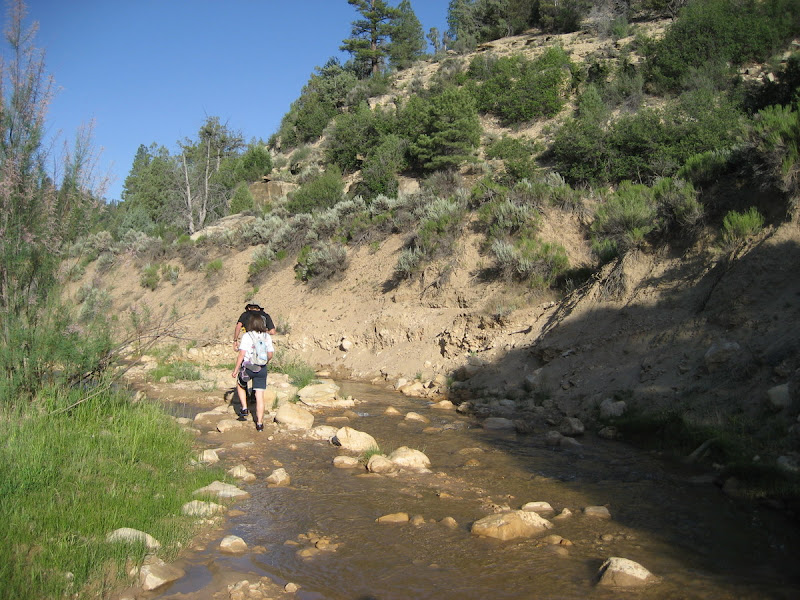
As a result of our precarious camping spot and the long hike, we got up early and took off down the canyon quickly. At first, it was just an open river rolling through farm land:


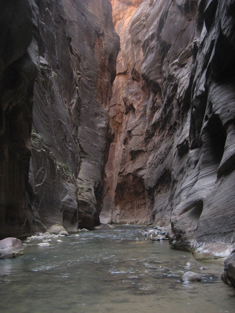
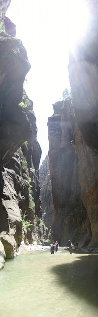
The canyon eventually shrunk down smaller and smaller... Finally, it was about 20 feet wide. If it flashed floods in here you're pretty much Done (capital D).


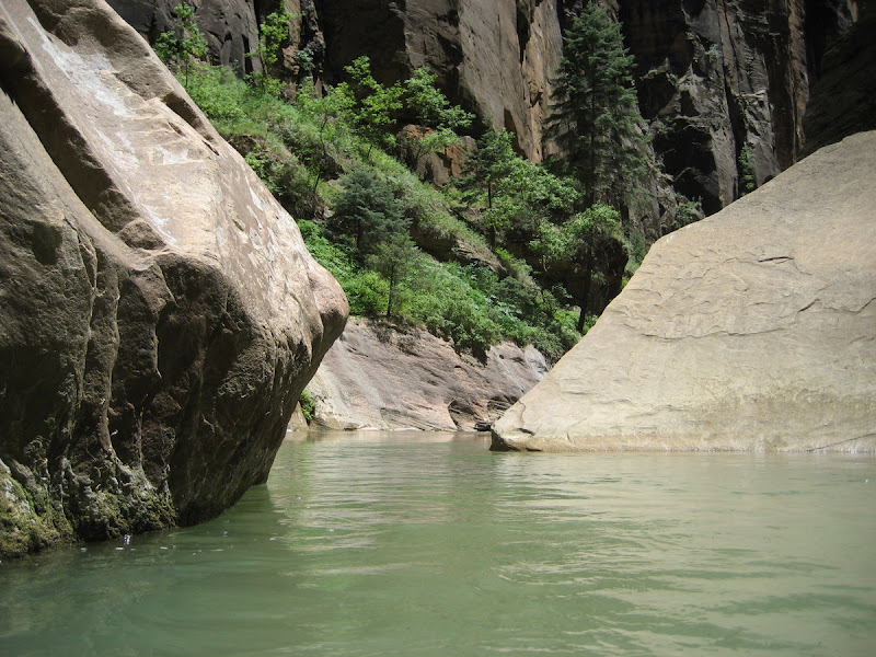
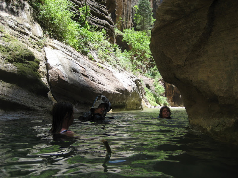
Since the hike follows a river through the canyon, getting wet is inevitable. At some point it's really best to embrace this and we hiked a lot (most) of the trip in the water. As we got farther in the Canyon, the water got deeper and deeper. This water is pretty much at head level.


Ideal hiking conditions:


I discovered that my backpack for some reason floats and acts like a lifevest. How cool is that?! I floated along whenever I could and this part was uber cool.

As we hiked along, more and more touristy looking people started showing up that were presumably from the other end of the canyon where you can do out-and-back hikes of however long you want. Some were pretty funny, hopefully they didn't hurt themselves.

Finally, we rolled out of the Narrows feeling a cool sense of accomplishment having taken the canyon from flatness through tight walls and back out into mountains.


The photos don't really do it justice, but panoramics kind of look better:


Have a good weekend!

Tuesday, June 19, 2007

High Uintazzzzzz

Two weekends ago, I decided it was time to get going on some of my overnight plans for the summer. The most logical choice for proximity was the High Uintas, a mountain range to the East of Salt Lake City.

It snowed in the mountains Wednesday and Thursday before my trip and the conditions were rather unknown. Regardless, I wanted to hit the mountains so I got my stuff ready Friday night for a Saturday/Sunday trip.

I took off Saturday morning and picked up a recreation pass. At the booth, I had a quality chat with the ranger lady:

Scott: "Do you know anything about snow up there... are snowshoes necessary?"
Wrinkly Lady: "I haven't been up there... wait... you're sleeping up there ... Oh god you're going to freeze."
Scott: "K, Thanks"

I headed up the Highline trail and worked my way to Rocky Sea Pass. The trail itself was a mix between pine forest and open alpine meadow... (click pictures for big versions)...


Six and a half miles in, I got to Carolyn Lake my planed camping
spot for the night. I wanted to press on to Rocky Sea Pass but
needed to refill water and check out the area. I was shocked to
see fish visible in the lake! Then I wandered over to a stream
with good water for pumping and discovered TONS of fish
fighting upstream. I counted more than a dozen visible in any
given pool, catching these suckers would have been a joke (insert
net, retrieve fish). All the long rock looking things are
actually fish....


I proceeded to Rocky Sea and eventually got out of the trees and
high into the pass. The views from the top were pretty epic.


The windcurls and cliffs demonstrated why this area has very few
trails to mountain peaks.


After getting back to Carolyn Lake I was very pleased to see
that no one else had planned to camp nearby. I had the entire
Lake to myself, noice!


I saw several shooting stars when gazing by the lake. The night
wasn't actually that cold. I think it froze outside (snow drifts
were icey in the morning), but I was cozy in my mummy bag.
Take that recreation pass lady.

The next morning, I got everything together to go back.
The hike back was fairly uneventful but pretty none the less.


It was definitely a good trip, I would certainly go back to the Uintas.
And am thinking about doing some day hikes in the area as it's
pretty close to SLC....

Free Hit Counter